Electric grid overhaul presents inspection challenges
Share article

It’s sometimes referred to as the world’s largest machine. The North American electric grid is an engineering marvel that shaped history and changed the lives of countless people since coming into existence.
For its next act, the grid must undergo a massive transformation to achieve the White House’s goal of 100% carbon-free electricity by 2035.
There needs to be a massive build-out of transmission lines to deliver power from areas with strong winds and bountiful sunshine to large population centers. According to one estimate, interregional transmission capacity will need to grow by two to three times current capacity.
Nor is the work complete once the transmission lines are built. Operators must continuously monitor power lines to ensure safe and reliable service.
One solution is based on satellite imagery, which can be incorporated into work flows to lower costs and increase efficiency.
It’s a topic we’ve written about before that has grown in importance by the day. Not only will there be many more miles of transmission lines, but the greater intensity and frequency of storms results in more damage that must be fixed.
Here’s a quick rundown of the issues involved:
What is the challenge?
- Operators have limited resources (workforce, budget) to inspect hundreds or even thousands of miles of right of way.
- They need to prioritize multiple, often remote, segments of right of way for routine or post-natural disaster inspections.
There are drawbacks to current practices
- Manual inspection is inherently dangerous and puts lives at risk.
- Aerial flyovers are costly and time consuming.
- Line of sight can be obstructed from the air.
- Ground patrols may have difficulty reaching remote locations.
What is the solution?
- Satellites can safely, quickly, and inexpensively provide imagery anywhere in the world.
- More specifically, the type of imagery is synthetic aperture radar (SAR), which works in all weather conditions, day or night.
The ideal solution utilizes a “Tip-and-Cue” method: Apply algorithms to lower-resolution imagery over a broad area to detect areas that require a closer look with higher-resolution imagery.
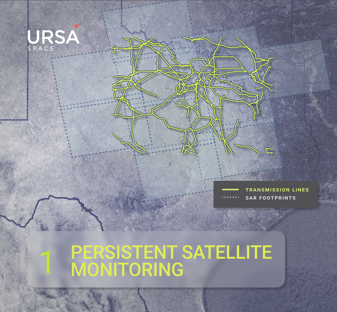
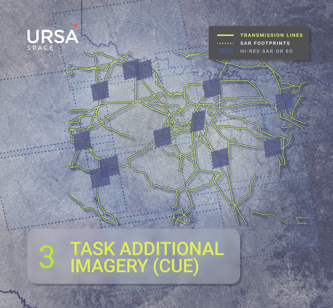
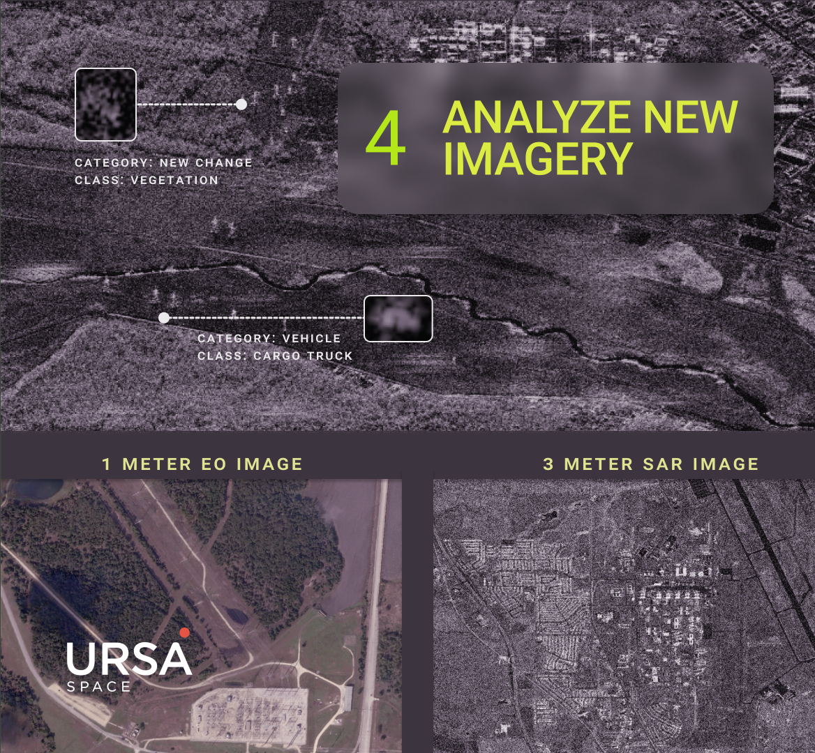
With access to satellite constellations (electro-optical, SAR, radio frequency, multispectral, etc) combined with customized analytics, Ursa Space leverages this Tip-and-Cue method to help power line operators monitor their assets.
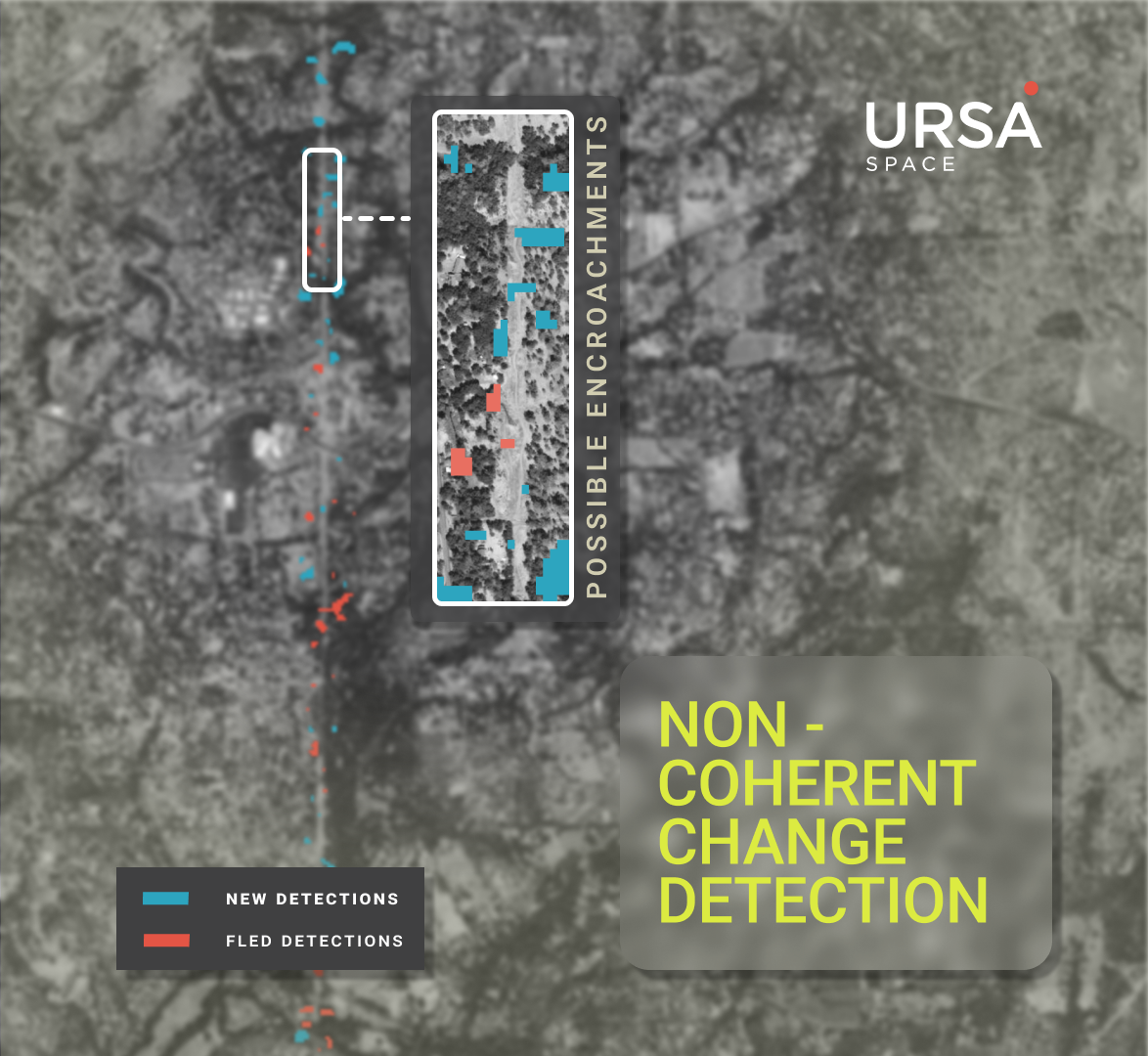
This process includes multiple analytic approaches using SAR and multi-modal sources to detect potential obstructions and damage incurred to equipment.
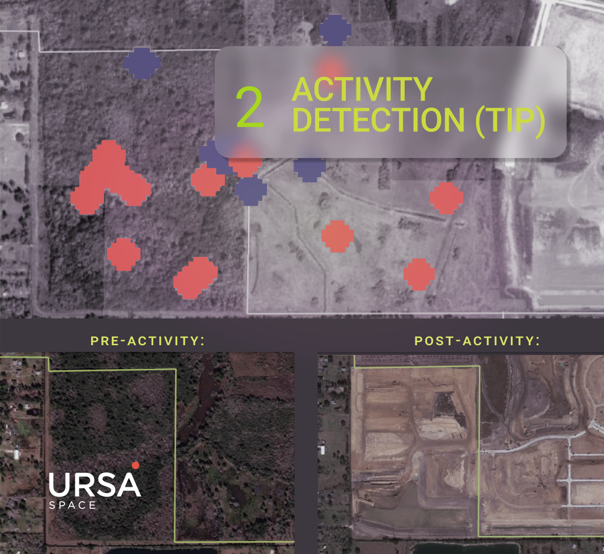
The types of obstructions that would trigger a closer look would include encroachments that could have catastrophic results unless addressed and remediated without delay.
Trees that grow too close to power lines or an excavator digging nearby need to be flagged immediately to avoid disasters.
A satellite imagery-based solution addresses this need because it can detect vegetation and man-made objects in right-of-way corridors, and even estimate their height to better understand the severity of the threat.
")
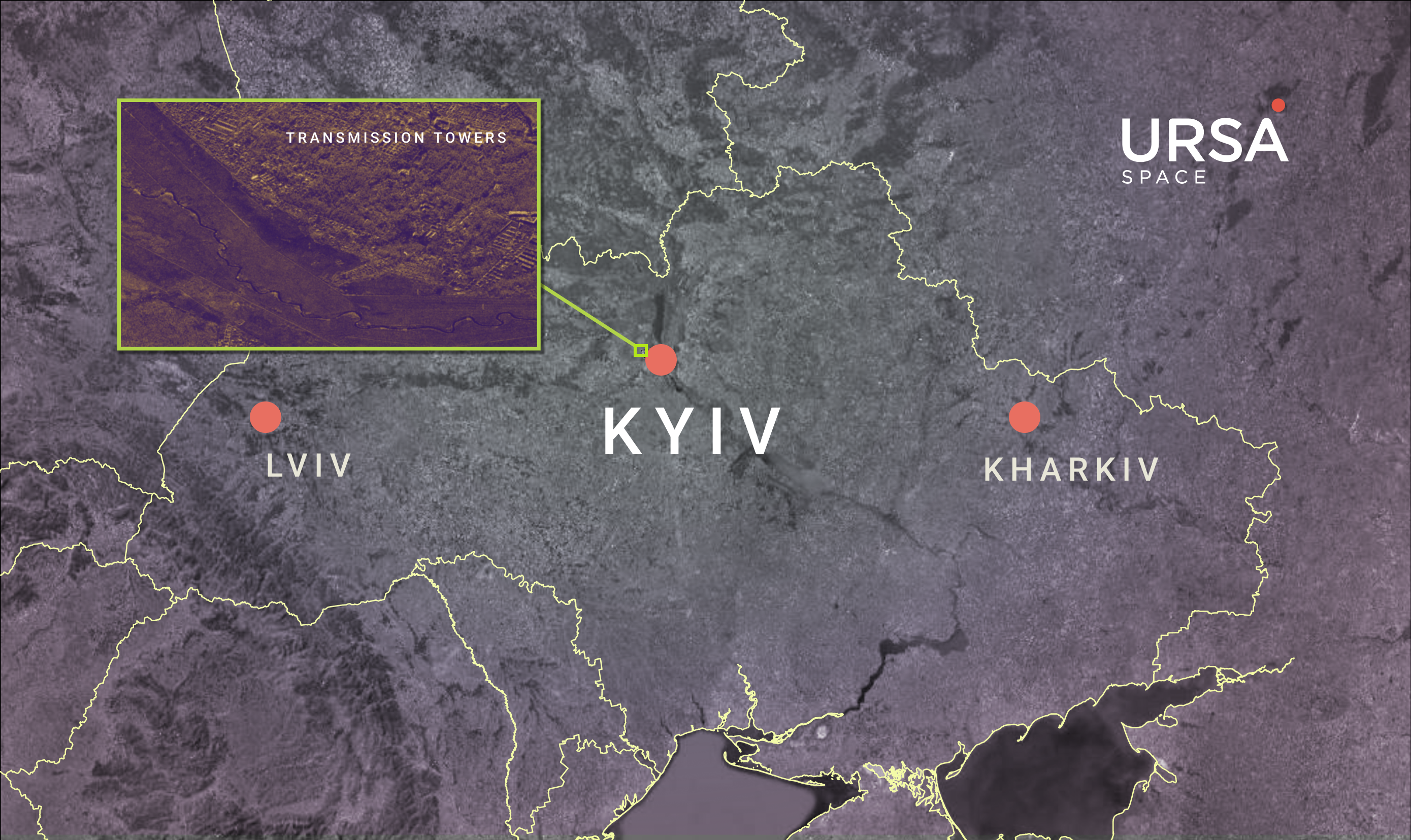
Another situation that warrants inspections is when heavy storms damage the electric grid and knock out power to customers. A similar predicament unfolds in conflict zones, including Ukraine, where energy infrastructure is targeted.
Utilities must quickly respond and allocate resources to areas where repairs are needed.
Ursa can assess whether the lines or equipment have been damaged using multiple modalities. For example, transmission poles are typically very large metal structures that have very distinct radar returns, making their identification possible.
If you are interested in our power line monitoring solutions, we’d love to hear from you. Please reach out by filling out the form below.
Share article