FAQ: What is SAR?
Share article
A picture is worth a thousand words. We’re all familiar with this phrase used to capture the essence of a photograph. How much more would a picture be worth if it not only showed the presence of an object, but also contained information on its precise location, distance, speed and direction of movement? This is exactly what is captured through synthetic aperture radar (SAR).
Synthetic aperture radar (SAR) is an imaging technology that offers capabilities to capture complex elements, including location, distance, speed, and direction of movement.
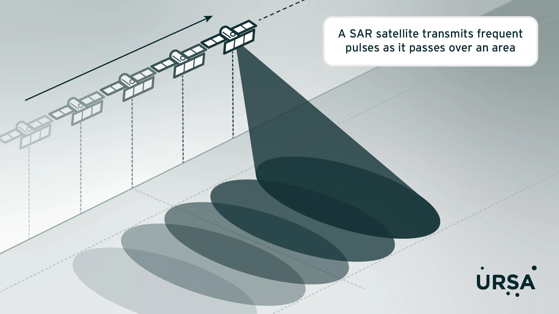
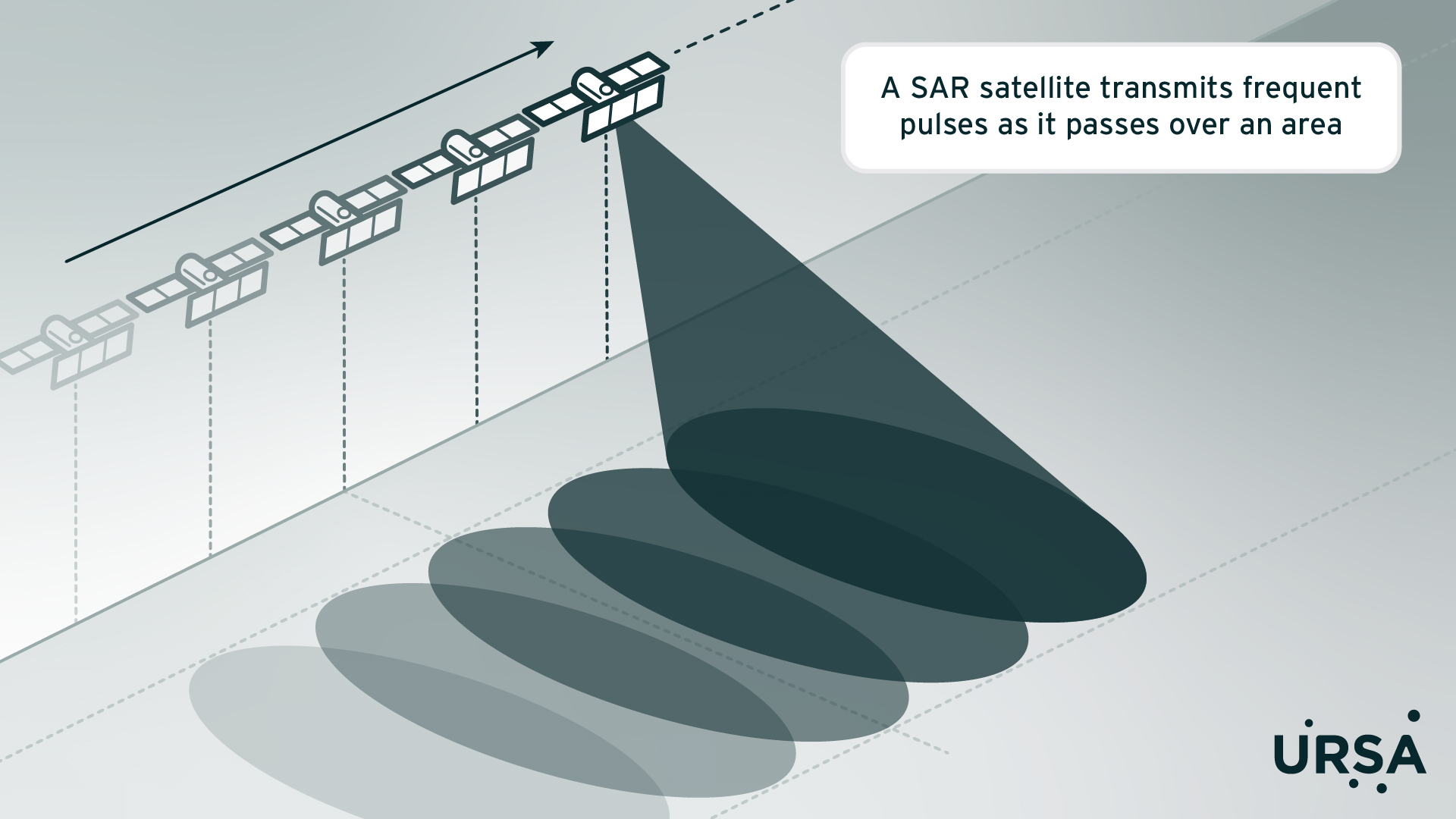
In a SAR imaging system, an active remote sensor mounted on a satellite or aircraft transmits pulses of radiofrequency (RF) energy toward an area of interest. These radar signals interact with the Earth’s surface. A portion of the signals are reflected back to the instrument, in patterns that carry rich information about size, orientation, composition, condition and texture of the features encountered—whether they’re related to land, water or human activity. These data are collected, digitized, stored, and can be processed to form an image for easy interpretation by the human eye.
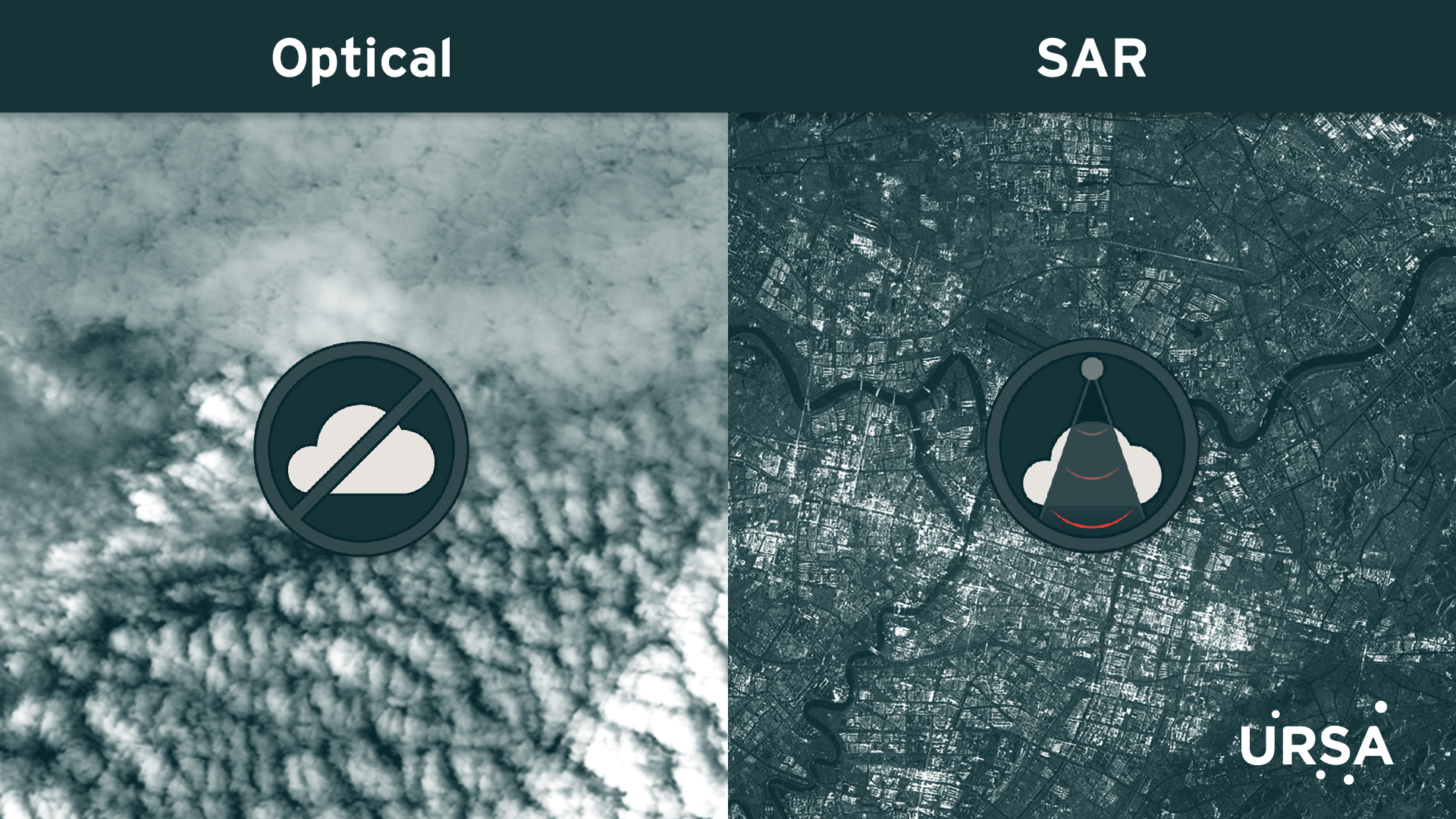
Unlike optical satellite imaging, which is similar to taking a picture with a camera and relies on sunlight, a SAR imaging system provides its own energy source, in the form of radiofrequency radiation. This approach offers a number of advantages:
- SAR works day or night, with no sun illumination requirements
- SAR works in any weather conditions, as radiofrequency radiation is not significantly affected by clouds, precipitation, or other atmospheric conditions
- SAR can collect data at different wavelengths and polarizations, to obtain different types of information, e.g., about surface structure and moisture content
- SAR can penetrate subsurface (vegetation, soil) to varied extent, depending on SAR wavelength
- SAR can gather information over large swaths at lower resolution or very detailed, high resolution images over smaller areas
- SAR collects data that can be processed, examined and combined with other types of data, including optical satellite data, in unique ways
What's synthetic about SAR?
Radar systems, including SAR systems, have an antenna that transmits and receives electromagnetic energy. The greater the size of the antenna, the more concentrated the beam of radiofrequency radiation that’s sent out, and the higher the spatial resolution—or amount of detail—that can be captured as the energy returns. Simplistically, the term “aperture” has to do with how much energy an antenna can receive.
A regular radar system (i.e., real aperture radar)’s capabilities are limited by the size of the antenna that can be sent into space. When this size is kept within practical bounds, the resulting resolution is only good enough for short range and low altitude applications, with small area coverage. To produce high resolution imaging of the Earth’s surface, the antenna needs to be hundreds of times greater in size than what can be carried on a satellite.
SAR is unique in that it overcomes this size vs. resolution issue in a very innovative way. It uses movement of its antenna to “synthesize” a larger aperture.
In a SAR system, the physical antenna is still short, but a synthetic aperture, or simulation of a large antenna, is created by the movement of the satellite or other platform on which it’s mounted. In other words, as the real, short antenna moves along the satellite’s orbital path and changes position over time, it collects radar signals from brief, closely spaced successive pulses. For a given area or object, many independent samples are collected from slightly varying positions. With advanced data recording and stepwise processing techniques, these collections are combined to produce a single high-resolution SAR image. In this way, a few-meter-long antenna can simulate one that is hundreds of times that length, “synthesizing” an aperture that can achieve high spatial resolution.

SAR has many real-world applications, especially in situations where optical systems can't deliver a clear image due to weather or daylight limitations (e.g., in areas above the Arctic Circle during Polar Night, when it remains dark for hundreds of hours, or in the Amazon rainforest, where it’s cloudy for extended periods of time). Regardless of the location on Earth, SAR can be used to detect, identify, measure, and geolocate objects; characterize changes over time; and track moving objects such as trucks, ships, and other vehicles.
One downside is that the complexity of SAR data can make it difficult to use and integrate into workflows. That’s where Ursa Space comes in. Our expertise in SAR data analytics allows customers to easily access the insights that SAR can provide.
Share article