Flood Monitoring: 2023 Hurricane Season

It has been an eventful few weeks for storm trackers.
The National Hurricane Center issued its first ever tropical storm watch for parts of southern California last month. Shortly after, a Category 4 hurricane barreled across the Gulf of Mexico en route to Florida, Georgia and the Carolinas.
During both Hurricane Hilary and Hurricane Idalia, Ursa Space provided near real time updates on locations where flooding had occurred by creating flood extent maps posted on social media (see below).
The basis for this output is satellite imagery, specifically synthetic aperture radar (SAR), an all-weather, 24/7 technology.
Our friends at Umbra collected (SAR) imagery over land in the storm’s path. We then applied algorithms designed to detect the presence of water. The results were overlaid on an optical base map.
This isn’t the first time we collaborated with Umbra to monitor a flooding event. Past examples include Typhoon Mawar in Guam and the Red River Valley’s seasonal thaw.
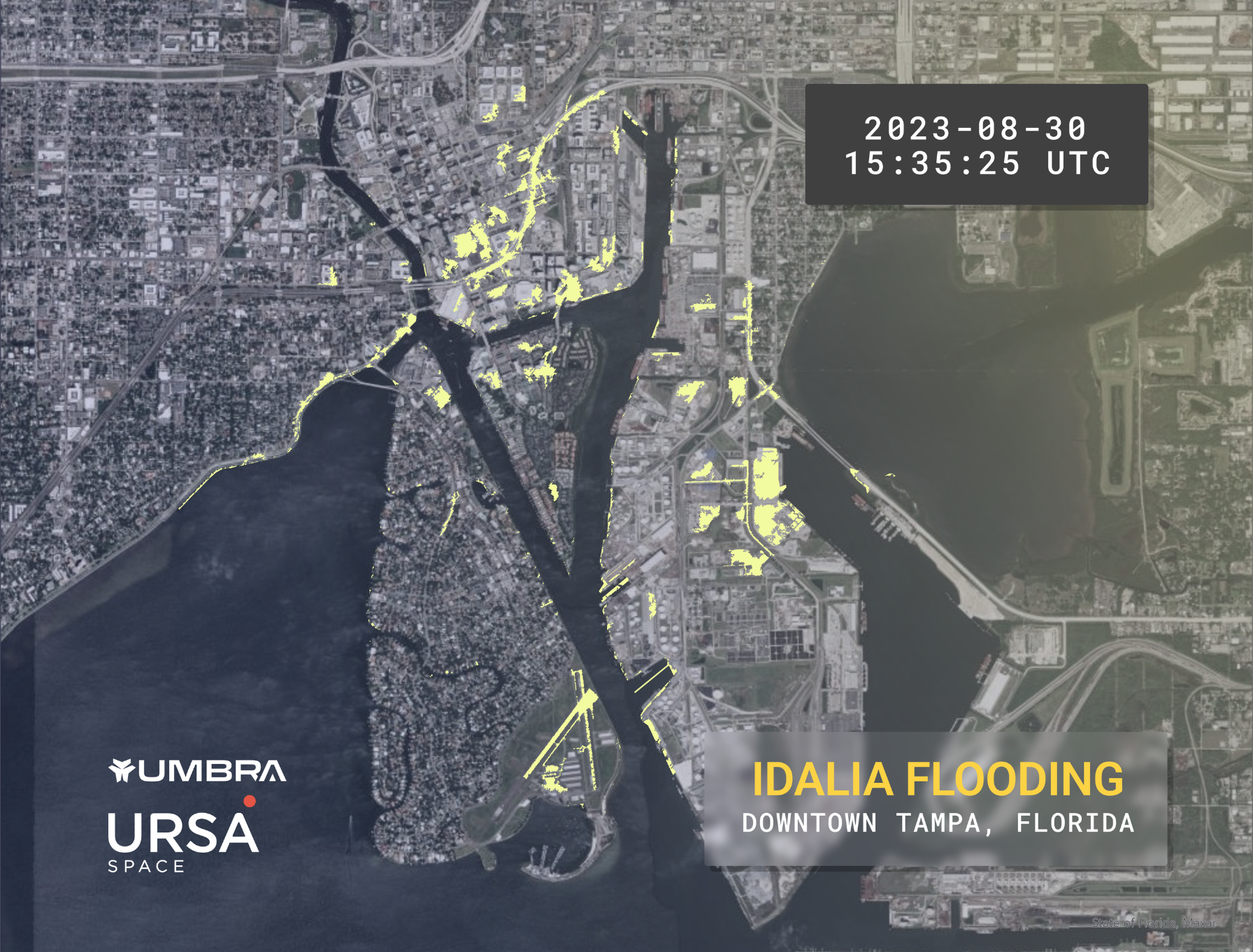
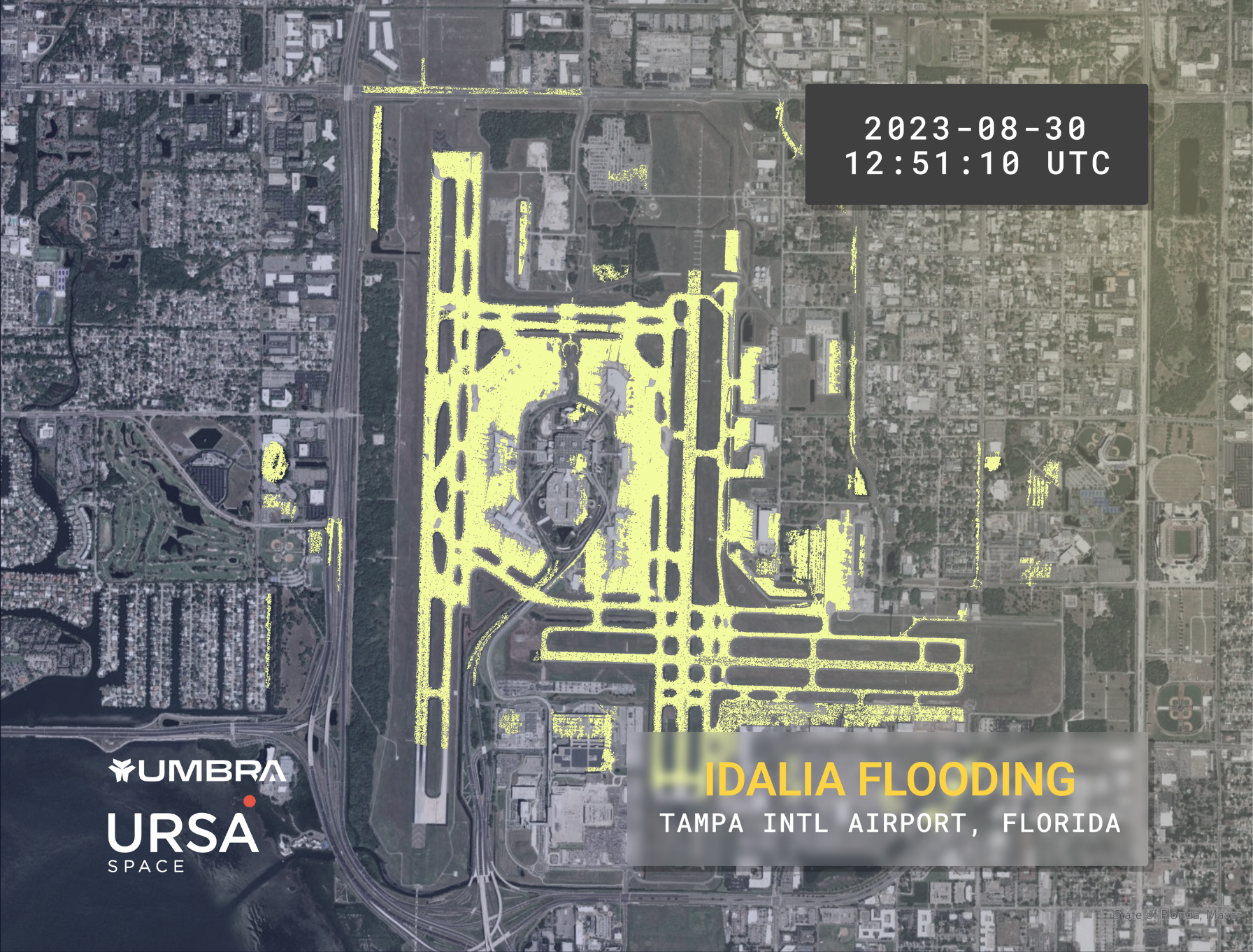
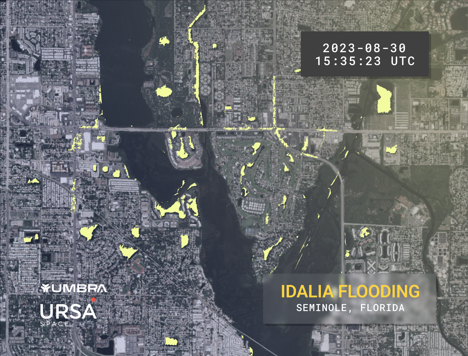
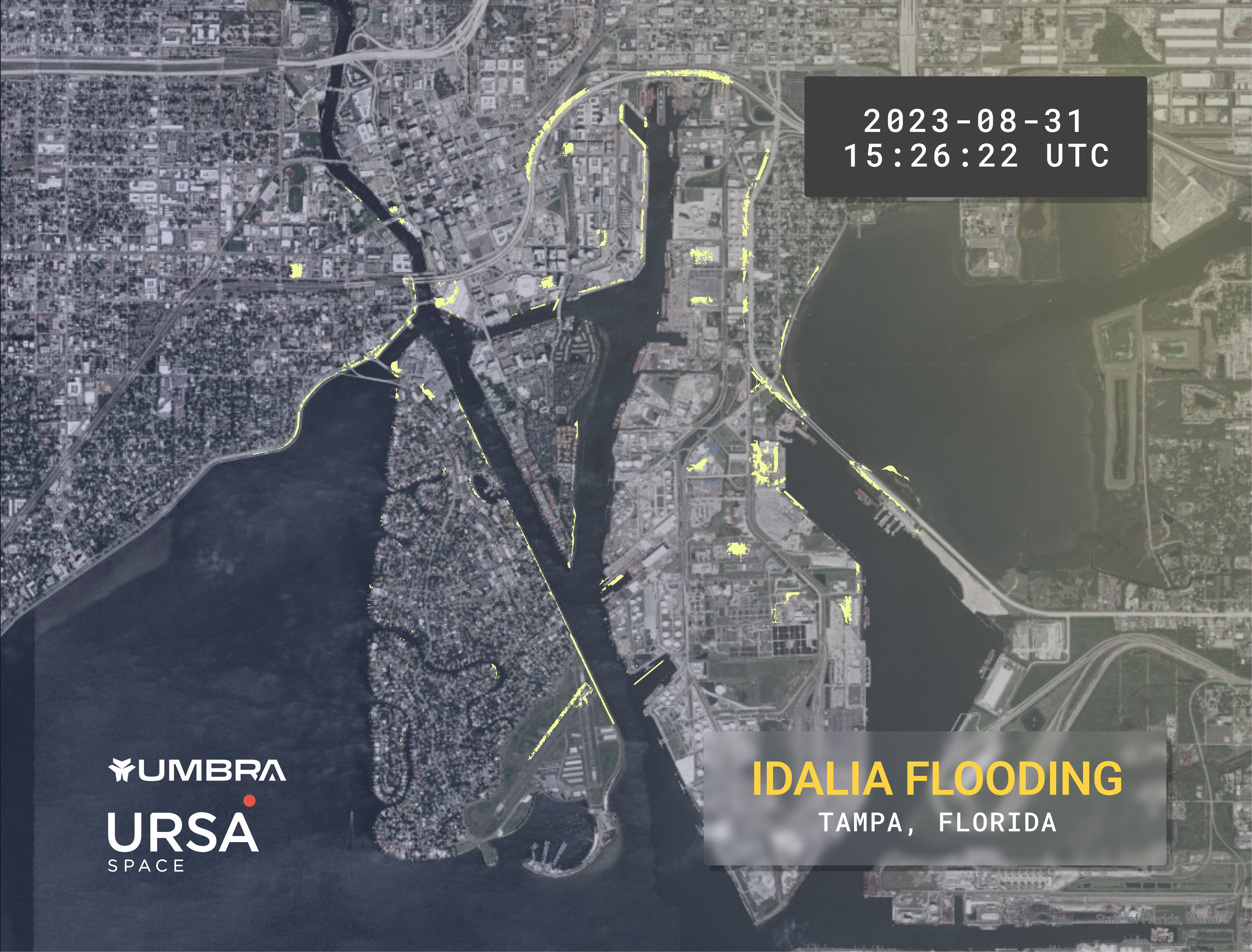
For Hurricane Idalia, we focused on Tampa and Seminole, a town northwest of St. Petersburg.
In Tampa, the areas most impacted included Downtown, the Channel District, the Port of Tampa, and Bayshore Blvd in South Tampa. Tampa International Airport saw minor flooding, as did major roadways in Seminole.
Next, we turned to Georgia and South Carolina, which stood in the path of the weakening storm.
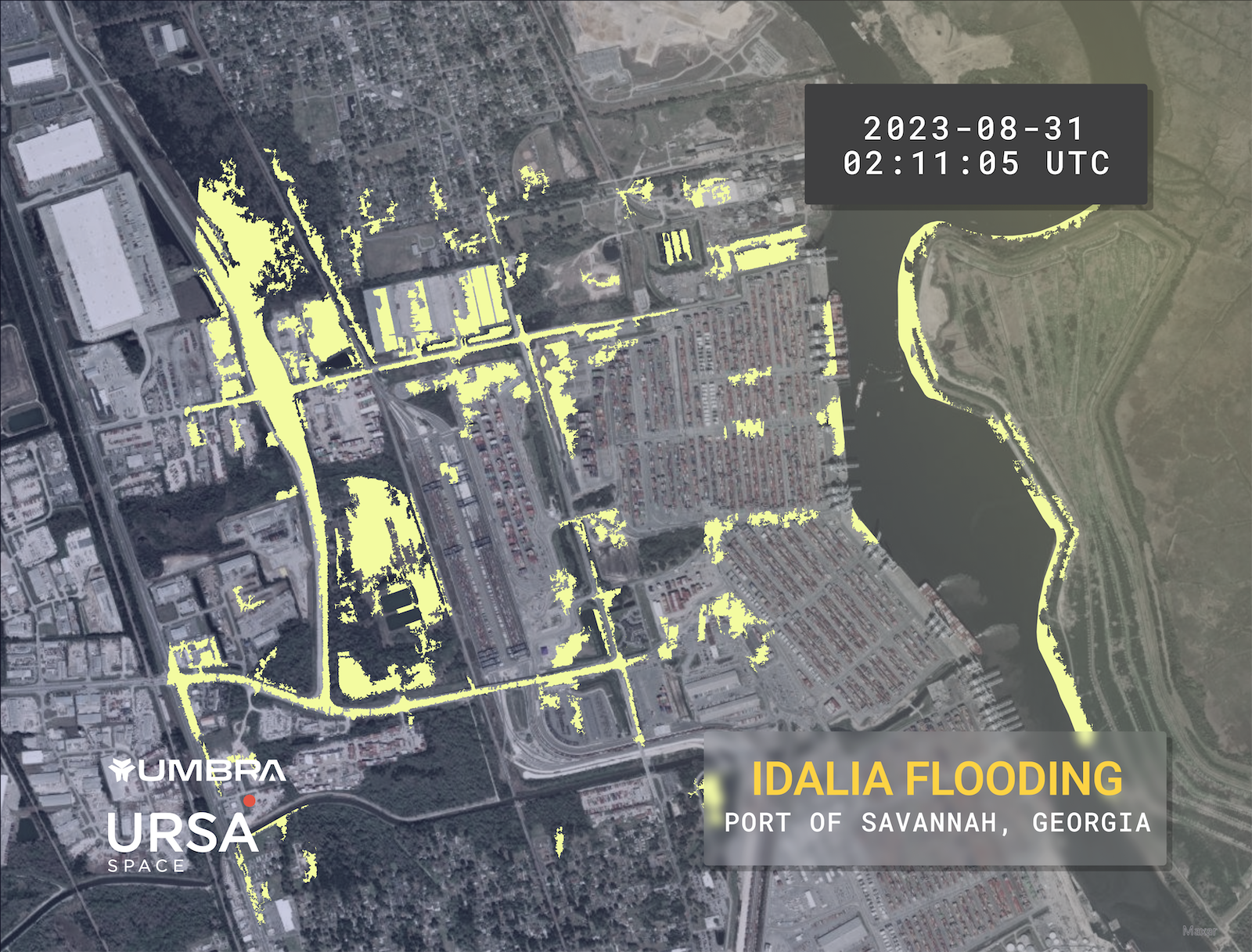
The Port of Savannah, a major shipping container terminal, closed operations as Hurricane Idalia crossed Georgia at category 2 strength. When operations resumed two days later, standing water remained at the port and surrounding roadways.
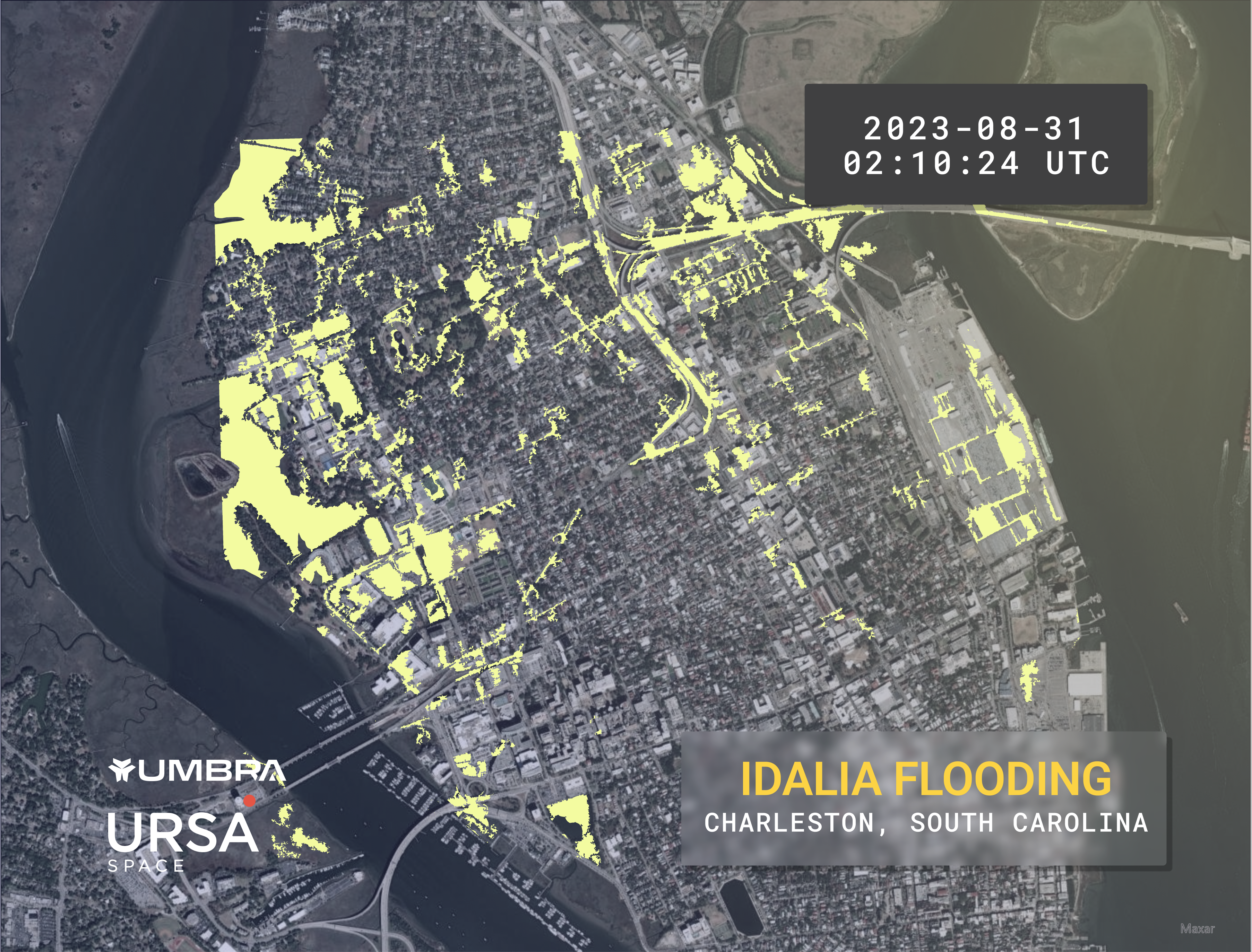
In Charleston, South Carolina, the storm caused extensive flooding. In the map below, flooding is apparent in various locations, including the Port of Charleston, as well as Brittlebank Park and Joseph Riley Jr. minor league baseball stadium.
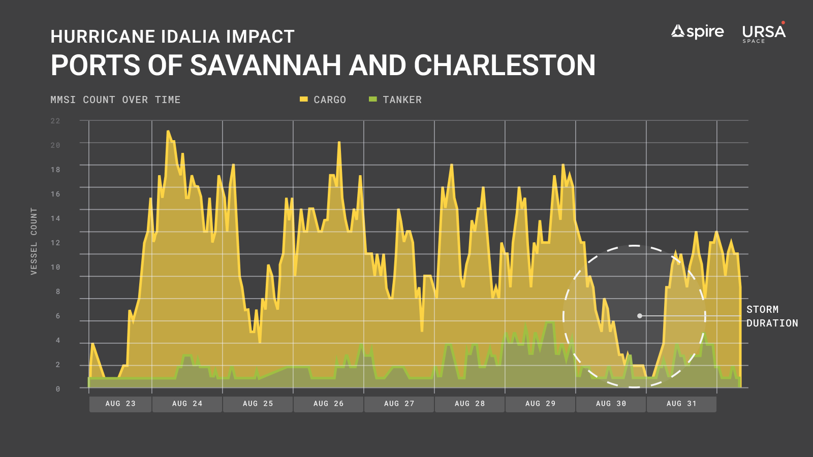
As mentioned, Charleston and Savannah are home to significant commercial ports. To gauge the change in shipping traffic, we plotted Spire AIS data into a graph to illustrates the significant drop that occurred due to the port closures and unsafe conditions.
Earlier in August, Hurricane Hilary made headlines as a Category 4 storm in the Pacific. After making landfall as a tropical storm, it tracked north from Mexico into Southern California, which is where we focused our efforts.
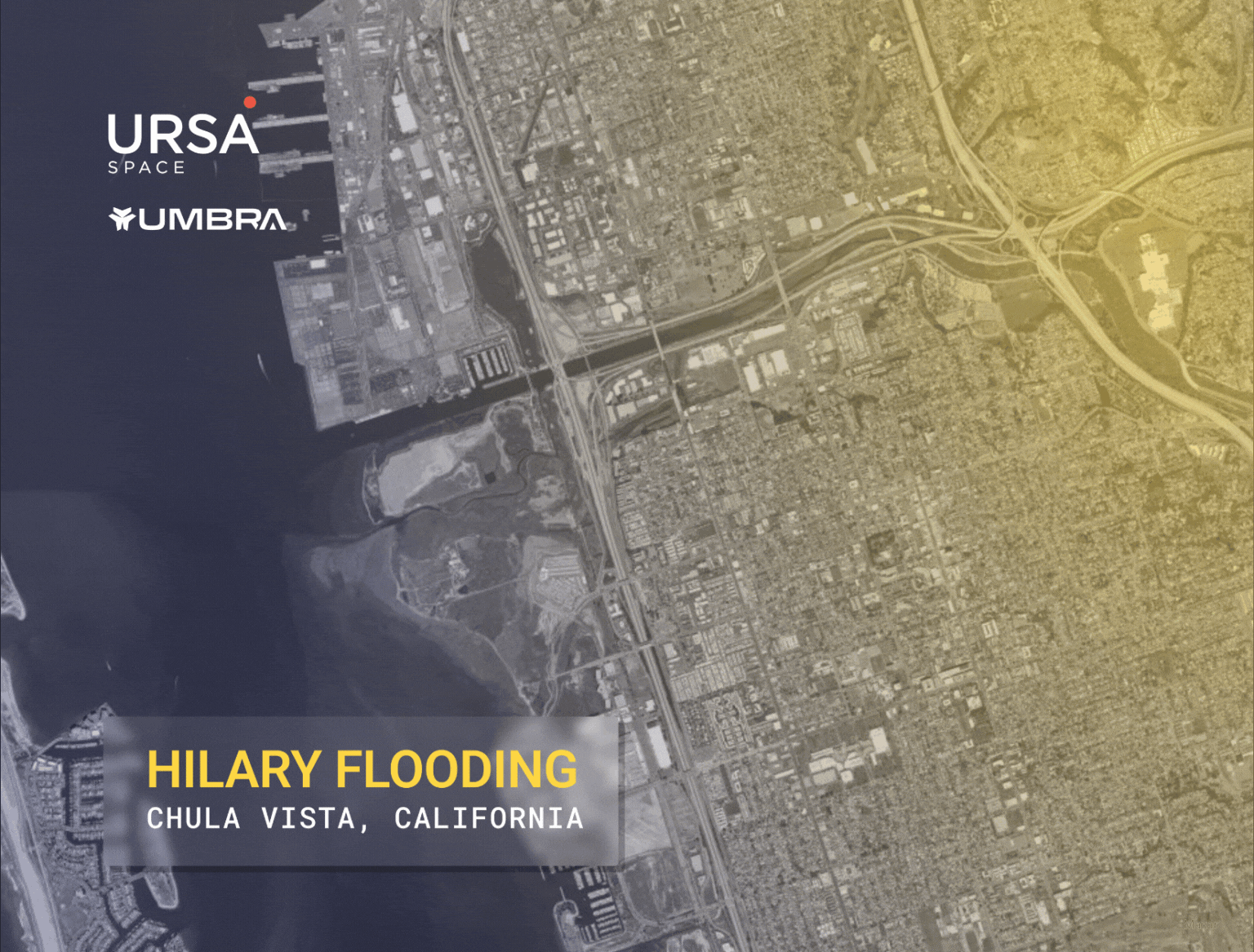
The San Diego County city of Chula Vista experienced some flooding, but the water receded rapidly, returning to pre-storm levels later the same day.
Unfortunately, there’s still plenty of time left in the 2023 hurricane season, which won’t be over until November 30. Meteorologists are tracking storms in Atlantic and Pacific waters.