Insights powered by GeoAI
Read our latest data-driven stories shaping markets, security, and the world.
The Ursa Space News Desk
How we’re using our technology to understand current events.

26
JAN 2021Story map: China Oil Storage Construction
Having trouble viewing this Story map? Click here to be redirected.
22
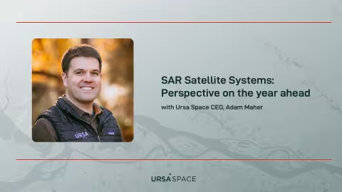
JAN 2021SAR Satellite Systems: Perspective on the year ahead
2021 has the makings for a stellar year in the remote sensing satellite industry, and for /blog/faq-what-is-sar">synthetic aperture radar (SAR) systems in particular. To spotlight new developments, we’ll be periodically posting entries—like this one—to share the thoughts and insights of Adam Maher, SAR satellite industry expert and CEO of Ursa Space Systems.

15
JAN 2021Satellite launches shift SAR industry into high gear

08
JAN 2021Ursans discuss SAR on alt-data podcast
18
DEC 20202020 Year in Review
This year, the COVID-19 pandemic caused wide-reaching upheaval, profoundly altering patterns of life across the globe. As the effect of widespread lockdowns spread, many of these changes could be seen from space. Ursa Space captured a subset of effects through satellite imagery, and discussed our findings on this blog.
It’s now that time to look back and provide a retrospective of a year unlike any before.
11
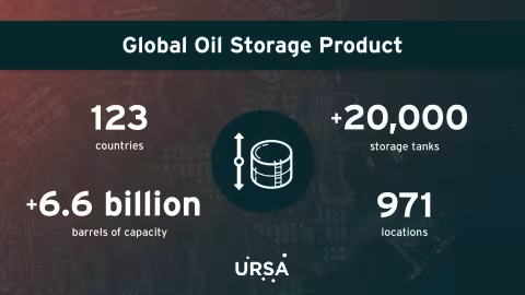
DEC 2020Ursa Space’s oil storage product expands to over 6.6 billion barrels of capacity

04
DEC 2020Holiday shopping, retail trends boost Amazon
20
NOV 2020What you missed: GEOINT Community Forum
19
NOV 2020FAQ: What is remote sensing?
Remote sensing is the process of acquiring information about objects or areas from a distance.
In broad terms, as you read this sentence, you are performing a type of remote sensing. Your eyes collect visible light waves reflected by the dark and light shapes in front of you, and your brain analyzes this information, assigning letters, words and meanings to the patterns.
In a geospatial context, remote sensing is defined as the collection of information about the Earth using satellites, aircraft, or drones.