Insights powered by GeoAI
Read our latest data-driven stories shaping markets, security, and the world.

The Ursa Space News Desk
How we’re using our technology to understand current events.

05
JUN 2023Typhoon Mawar: Ursa, New Light Technologies collaborate to identify flooding
It was the strongest storm to hit Guam in over two decades. Typhoon Mawar hammered the Pacific island with sustained winds over 140 miles per hour and torrential rain, knocking out power to most of the 150,000 residents and causing widespread flooding.
Fortunately, there were no reported fatalities or major injuries on Guam, which is also a critical hub for U.S. forces in the Pacific.

19
MAY 2023Vessel Detection: Monitoring China’s Maritime Militia
The South China Sea is home to significant mineral deposits, oil & gas reserves, and major shipping lanes, making it one of the world’s geopolitical hotspots.
With much at stake, China has been locked in a years-long contest with its neighbors over competing claims of sovereignty.
One of the techniques to assert de facto control has involved hundreds of Chinese fishing boats, which cluster in large groups as a display of force, comprising an unconventional naval force, known as the People’s Armed Forces Maritime Militia (PAFMM).

18
MAY 2023Umbra and Ursa Space Empower Global Market with Advanced SAR Analytics through Strategic Partnership
Ithaca, N.Y. and Santa Barbara, Calif. – May 18, 2023 – Ursa Space Systems, a leader in satellite intelligence, and Umbra, a leader in advanced space radar technology, today jointly announced that they are partnering to bring advanced synthetic aperture radar (SAR) analytics to a global market through Ursa’s suite of subscription and custom intelligence products.

11
MAY 2023Flood detection: Red River Valley prepares for spring thaw
It is that time of year when the spring snowmelt followed by the start of the Atlantic hurricane season raises concerns about flooding in many parts of the United States.
Despite the attention, with so many flooding events spread across an expansive area, data collection remains a monumental task.
The need for ground truth is critical not only for the people in harm’s way, but also for the professionals responsible for providing services during natural catastrophes, including emergency responders and insurers.

27
APR 2023Aircraft Detection: Monitoring China’s Economy Post COVID Controls
The surprise decision by China to lift travel restrictions in late 2022 marked a major reversal from the stringent policies in place since 2020 designed to curb the spread of COVID-19.
With many more people expected to move around China, as well as enter and leave, the economic implications are significant.

18
APR 2023Ursa Space, Geosite Team Respond to Australia Flooding Event
South Australia experienced some of its worst flooding in recent memory when flood levees failed late last year along the Murray River, inundating the region and causing serious property damage.
In events like this one, processing insurance claims as quickly as possible is critical for individuals affected by the flood. In recent years, satellite imagery has emerged as a powerful resource for claims processors to rapidly and holistically assess area conditions after a catastrophic event.

04
APR 2023Planet Joins Ursa Space’s Virtual Constellation and Partner Network
ITHACA, NEW YORK – April 4, 2023 - Ursa Space Systems, a global satellite intelligence infrastructure provider, has announced today that Planet Labs PBC (NYSE: PL), a leading provider of daily data and insights about Earth, will join its Virtual Constellation and Partner Network.

29
MAR 2023Global Economic Outlook Hinges on China
After years of stringent COVID restrictions, China’s reopening quickly became one of the key forces expected to influence the global economy in 2023.
The International Monetary Fund said at the start of the year that China and India would combine for half of the total global growth.
23
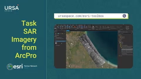
MAR 2023How to get started using Ursa’s ArcGIS Pro Toolbox
Ursa Space /blog/esri-python-toolbox/" target="_blank" rel="noopener">unveiled recently a Python toolbox for satellite analytic and data ordering within Esri ArcGIS Pro, a full-featured professional desktop GIS application.
The toolbox marks a step forward in the adoption of satellite analytics and data. Esri software is deployed in more than 350,000 organizations globally, while Ursa Space leverages the world’s largest commercial satellite network to create analytic products across market verticals.